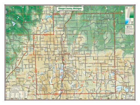
Otsego County sits astride the central highlands of the northern Lower Peninsula. Depicted in 20-meter relief, map coverage extends from the US-131 corridor in the west to the Twin Lakes in the east.
Giclée print on acid-free premium coated stock.
Item# – OOPR18 – 24″ x 18″
Item# – OOPR27 – 32″ x 24″
24″ x 18″ – $24.00 (Print)
24″ x 18″ – $36.00 (Laminated Print)
32″ x 24″ – $36.00 (Lg Print)
32″ x 24″ – $66.00 (Lg Laminated Print)
All county maps contain the following features:
- Land forms depicted in color-coded physical relief.
- Depth of large bodies of water depicted in shades of blue.
- Complete road grid down to local roads and some two-tracks.
- Snowmobile & ORV Trails, Rail-to-Trail, Non-Motorized Trails
- Parks, Trailheads, Boat & Kayak Launches, Historical Sites
- Other Points of Interest • Basic Statistics
For info on paper and print quality, click here.