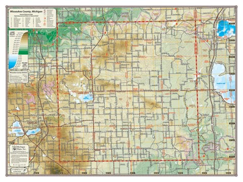
A landscape of small farms and forest lands, sparsely populated Missaukee County dips into the Manistee River valley in the northeast, but most of the county’s terrain drains into the Muskegon River and makes up its headwaters, along with Houghton and Higgins Lakes to the east. Lake Missaukee is the largest body of water in the County, adjacent to Lake City, the only population center of size. McBain and Falmouth round out the main communities.
Item# – MSKCOSM – 24″ x 18″ – $24.00 (Print)
Item# – MSKCOSM-L – 24″ x 18″ – $36.00 (Laminated Print)
Item# – MSKCOLG – 32″ x 24″ – $36.00 (Lg Print)
Item# – MSKCOLG-L – 32″ x 24″ – $66.00 (Lg Laminated Print)
All county maps contain the following features:
- Land forms depicted in color-coded physical relief.
- Depth of large bodies of water depicted in shades of blue.
- Complete road grid down to local roads and some two-tracks.
- Snowmobile & ORV Trails, Rail-to-Trail, Non-Motorized Trails
- Parks, Trailheads, Boat & Kayak Launches, Historical Sites
- Other Points of Interest • Basic Statistics