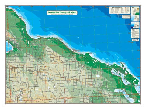
Presque Isle County’s long Lake Huron shoreline dominates this map and the depths of Huron create a striking contrast to the interior highlands. Coverage area includes Grand Lake and Long Lake, to eastern Black Lake.
Item# – PRSQSM – 24″ x 18″
24″ x 18″ – $24.00 (Print)
24″ x 18″ – $36.00 (Laminated Print)
Item# – PRSQLG – 32″ x 24″
32″ x 24″ – $36.00 (Print)
32″ x 24″ – $66.00 (Laminated Print)
All county maps contain the following features:
- Land forms depicted in color-coded physical relief.
- Depth of large bodies of water depicted in shades of blue.
- Complete road grid down to local roads and some two-tracks.
- Snowmobile & ORV Trails, Rail-to-Trail, Non-Motorized Trails
- Parks, Trailheads, Boat & Kayak Launches, Historical Sites
- Other Points of Interest • Basic Statistics
For info on paper and print quality, click here.