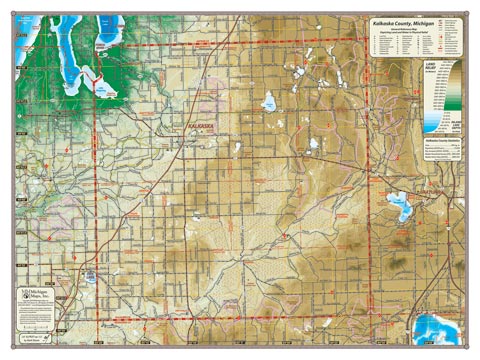
Mostly forested uplands made up of glacial moraines, Kalkaska County appears as a vast area on the edge of so many other places—Grand Traverse to the west, Grayling to the east, Torch Lake to the northwest, Higgins Lake to the southeast (all showing on the map)—with the village of Kalkaska (the only town of any size) right about in the middle. The sparsely populated expanse of the wild and less well known upper Manistee River valley dominates the County on the east.
Item# – KLKCOSM – 24″ x 18″ – $24.00 (Print)
Item# – KLKCOSM-L – 24″ x 18″ – $36.00 (Laminated Print)
Item# – KLKCOLG – 32″ x 24″ – $36.00 (Lg Print)
Item# – KLKCOLG-L – 32″ x 24″ – $66.00 (Lg Laminated Print)
All county maps contain the following features:
- Land forms depicted in color-coded physical relief.
- Depth of large bodies of water depicted in shades of blue.
- Complete road grid down to local roads and some two-tracks.
- Snowmobile & ORV Trails, Rail-to-Trail, Non-Motorized Trails
- Parks, Trailheads, Boat & Kayak Launches, Historical Sites
- Other Points of Interest • Basic Statistics