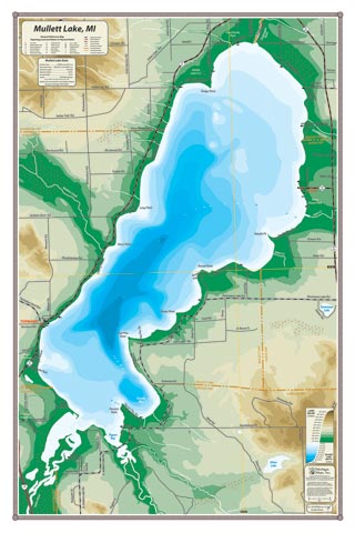
Named for John Mullett, the 19th century surveyor of Michigan, at over 140′ deep, Mullet is the deepest lake in the Inland Waterway. The historic resort of Topinabee, Aloha State Park and Pigeon Bay (the estuary of the storied Pigeon River) appear on this map.
All our lake maps include:
- Land forms depicted in color-coded physical relief.
- Depth of large bodies of water depicted in shades of blue.
- Complete public road grid right down to local roads.
- Parks, Boat Launches, Swimming, Preserves, Marinas
- Cultural Sites, Boundaries, Other Points of Interest
- Basic Statistics
Item# MLTLK – 16″ x 24″ – $24.00 (Print)
Item# MLTLK-L – 16″ x 24″ – $36.00 (Laminated Print)