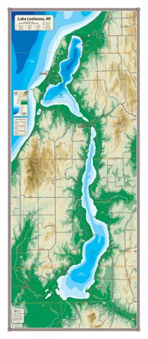
Lying in the central valley of Leelanau County, Lake Leelanau—hydrologically speaking, is actually comprised of two separate lakes. South Lake Leelanau is larger, shallower and warmer with an average depth of 25′. North Lake Leelanau’s average depth is 43′ and its deepest point is 121′, which keeps it cool late into the summer. Three communities are accessible from the lake: Cedar (via scenic Victoria Creek), Leland (up to a block from Lake Michigan), and Lake Leelanau (where the strait connects the two basins).
All our lake maps include:
- Land forms depicted in color-coded physical relief.
- Depth of large bodies of water depicted in shades of blue.
- Complete public road grid right down to local roads.
- Parks, Boat Launches, Swimming, Preserves, Marinas
- Cultural Sites, Boundaries, Other Points of Interest
- Basic Statistics
Item# LKLEL – 16″ x 36″ – $29.00 (Print)
Item# LKLEL-L – 16″ x 36″ – $44.00 (Laminated Print)