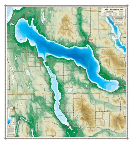
With navigable access to Lake Michigan, Lake Charlevoix abuts several cities that can lay claim as Great Lakes ports: Charlevoix, Boyne City, and East Jordan (all these towns have heavy industrial pasts), a rich cultural heritage evident in the old resort community of Horton Bay frequented by a young Ernest Hemingway, and the still operating Ironton Ferry. It’s also huge (26.5 square miles) with 56 miles of shoreline, and varied: the main basin gets 122′ deep and is cold; the South Arm is narrow and shallow with the Jordan River estuary at the south end (a wildlife and paddling Mecca).
All our lake maps include:
- Land forms depicted in color-coded physical relief.
- Depth of large bodies of water depicted in shades of blue.
- Complete public road grid right down to local roads.
- Parks, Boat Launches, Swimming, Preserves, Marinas
- Cultural Sites, Boundaries, Other Points of Interest
- Basic Statistics
Item# CHXLK – 22″ x 24″ – $29.00 (Print)
Item# CHXLK-L – 22″ x 24″ – $44.00 (Laminated Print)