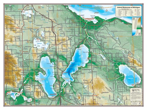
No navigable network or chain of lakes in Michigan (or anywhere else) rivals the Inland Waterway for breadth, variety and historical significance. By use of only two locks, a boat can travel from Conway (just east of Petoskey) all the way to Cheboygan and Lake Huron, or south to Alverno Dam on Black Lake. This map includes the entire waterway, including Crooked, Pickerel, Burt, Mullett and Black Lakes, and the Crooked, Indian, Cheboygan and Black Rivers. The shore towns of Conway, Alanson, Indian River, Topinabee and Cheboygan all appear on this map.
Note that this is a simplified version of the 32″ x 24″ version in order to fit a smaller wall space. If you have the room, purchase the 32″ x 24″ model.
All our lake maps include:
- Land forms depicted in color-coded physical relief.
- Depth of large bodies of water depicted in shades of blue.
- Complete public road grid right down to local roads.
- Parks, Boat Launches, Swimming, Preserves, Marinas
- Cultural Sites, Boundaries, Other Points of Interest
- Basic Statistics
Item# – IWSM – 24″ x 18″ – $24.00 (Print)
Item# – IWSM-L – 24″ x 18″ – $36.00 (Laminated Print)