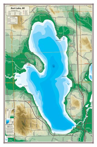
Named after William Austin Burt, the other 19th century surveyor of Michigan (see Mullett Lake, boy these guys must have really been amazing—namesakes of two huge and amazing lakes), Burt Lake makes up a central portion of the Inland Waterway. Three major rivers contribute to Burt Lake: the Crooked River, the Maple River and the Sturgeon River. Indian River is the only community on the lake, near Burt Lake State Park and the Cross in the Woods shrine.
All our lake maps include:
- Land forms depicted in color-coded physical relief.
- Depth of large bodies of water depicted in shades of blue.
- Complete public road grid right down to local roads.
- Parks, Boat Launches, Swimming, Preserves, Marinas
- Cultural Sites, Boundaries, Other Points of Interest
- Basic Statistics
BRTLK – 16″ x 24″ – $24.00 (Print)
BRTLK-L – 16″ x 24″ – $36.00 (Laminated Print)