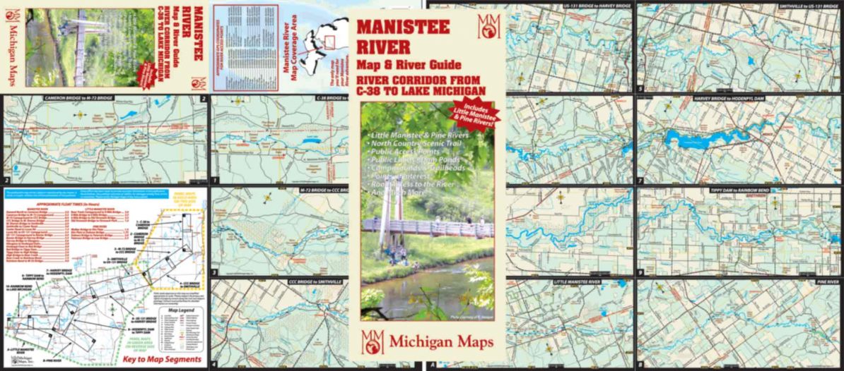
This map follows the great Manistee River from the bridge at County Road 38 east of Mancelona all the way to the city of Manistee on the shores of Lake Michigan in 10 highly detailed panels, 2 additional panels cover the important tributaries of Little Manistee and Pine Rivers. Each panel covers a stretch of this famous river in detail—public lands, public accesses, ramps, campgrounds, trailheads, road accesses to the river, cultural sites and more. Even the CE lands, USFS roads and riverside campsites are identified. Latitude and longitude lines allow you to locate your GPS coordinates on the map, and we include a list of GPS coordinates for the important access sites. We include a table of paddle times for the most traveled segments of the river. In other words, if you are planning to explore the Manistee by land or water, this is a must-have item. I love this river and wish I could have it all to myself, but I’m willing to sell you this map and share it with you anyway. Have fun!
Map size is 18″ x 16″ open, 4″ x 9″ folded,.
Item # – MNRVPK – $5.00