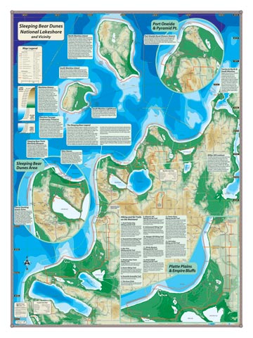
This is the map to share and recall your memories of a Sleeping Bear Dunes National Lakeshore vacation. The entire park, including the Manitou Islands, is depicted in physical relief from Leland in the north to Frankfurt in the south, and of course Glen Arbor and Empire. Enlarged break out maps of the three units of the park make it easy to read, locate and follow all the trails, interesting features, and cultural sites. There’s also lots of supplemental information about various aspects of the park. Check out the folding pocket version of this map—it’s a useful tool while you’re in the field (to see pocket map, CLICK HERE).
Item# SLPBRSM – 18″ x 24″ – $24.00 (Print)
Item# SLPBRSM-L – 18″ x 24″ – $36.00 (Laminated Print)
Item# SLPBRLG – 24″ x 32″ – $36.00 (Lg Print)
Item# SLPBRLG-L – 24″ x 32″ – $66.00 (Lg Laminated Print)
