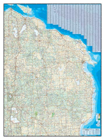
We offer two similar maps of Northeast Michigan, this one is the practical one. It shows public and open lands, so it appeals to the hunter, angler or generic lover of the natural outdoors. Coverage: Tawas City to Mackinaw City, I-75/127 to Lake Huron. This is a fully featured reference map in local road level of detail, that includes a full complement of topographic features. The map includes road and town indexes in alphabetical order and coded to a grid for easy location. Very few maps, if any, show this huge area of Michigan in comparable detail.
This map also includes:
- Land forms depicted in color-coded public/private land
- Complete public road grid right down to local roads
- Snowmobile, ORV, Non-Motorized Trails, Trailheads
- Parks, Boat Launches, Swimming, Preserves, Marinas
- Cultural Sites, Boundaries, Other Points of Interest
Item# – NEPL27 – 24 ” x 32″
24″ x 32″ – $36.00 (Print)
24″ x 32″ – $66.00 (Laminated Print)